Structure and Components
Structure and Components of the Bhitti Yantra
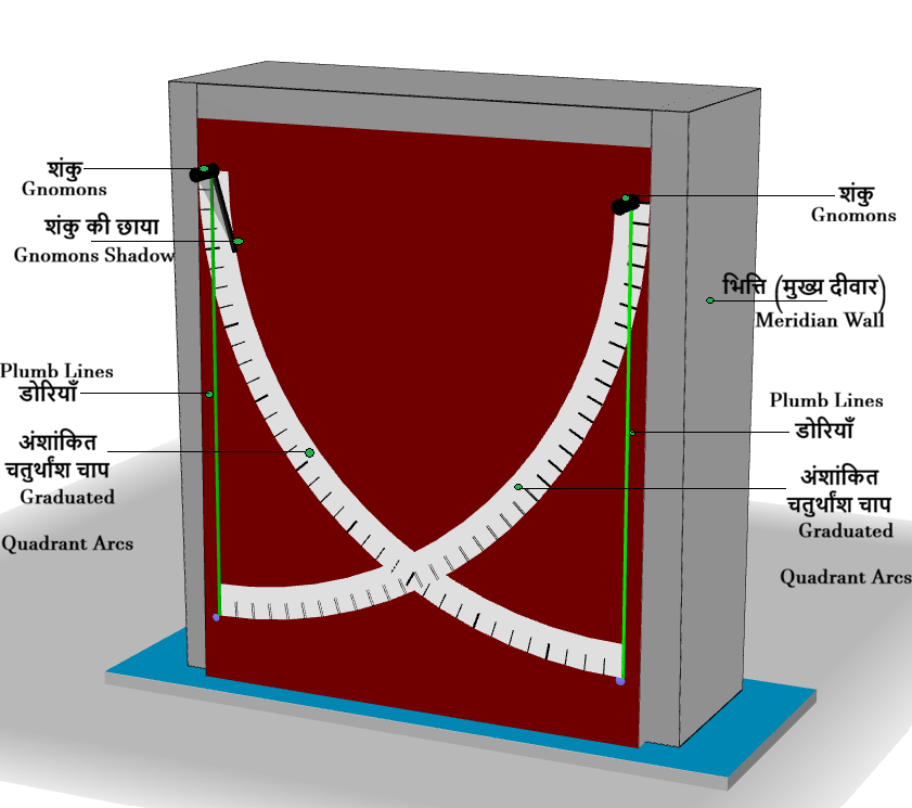
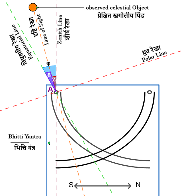
The Bhitti Yantra consists of a large, rigid vertical wall precisely aligned with the north–south meridian plane. Both of its faces (the east-facing and west-facing surfaces) are used for astronomical observations. The instrument is designed according to precise geometrical and astronomical principles, enabling highly accurate measurements of the positions of the Sun, planets, and stars.
Main Components of the Bhitti Yantra
- Meridian Wall: The principal component of the Bhitti Yantra is a large, flat wall erected exactly in the meridian plane. Its surface is vertical, i.e., perpendicular to the local horizontal plane, and serves as the fundamental reference plane for astronomical observations and measurements.
- Gnomons: Two gnomons are mounted at the upper corners of the meridian wall, projecting perpendicular to its surface. These form the essential observing elements of the instrument. During the forenoon and afternoon, their shadows fall on the wall and are used to determine the positions and motions of celestial objects.
- Graduated Quadrant Arcs: Two graduated quadrant arcs are constructed using the two gnomons as their respective centers, each having a radius equal to the distance between the gnomons. The arcs are finely graduated for precise angular measurements and intersect at a common point. When the observed celestial object lies south of the Prime Vertical Plane passing through this point, observations are made using the southern gnomon and its corresponding quadrant arc. Conversely, when the object lies to the north of the Prime Vertical Plane, the northern gnomon and its quadrant arc are used.
- Plumb Lines: A plumb line is suspended from each gnomon, with a length slightly greater than the radius of the corresponding quadrant arc. These lines are used to align the shadow of the gnomon or the observed celestial object, thereby improving the accuracy of astronomical observations and measurements.
Since the meridian wall is aligned precisely along the north–south direction, both its eastern and western faces can be used for observations at different times of the day. At Local Solar Noon, when the Sun crosses the local meridian, the shadow of the gnomon falls at a definite point on the graduated quadrant. From this position, the Sun's meridian altitude, declination, and the instant of Local Solar Noon can be determined.
The Bhitti Yantra at the Ujjain Observatory is constructed of stone and carries finely engraved angular graduations on its east-facing surface. It has been scientifically designed for the latitude of Ujjain (approximately 23.18° N), enabling highly precise astronomical observations and measurements.